Championing Environmental Stewardship with MEFFEL:Reforestation Tracking, Pollution Detection, and Biodiversity Mapping
As the global community confronts escalating ecological challenges—ranging from deforestation to water and air contamination—innovative approaches to environmental management are becoming increasingly indispensable. A sustainable future depends on clear-eyed assessments, effective interventions, and continual monitoring. At MEFFEL, we bring together cutting-edge technologies and scientific expertise to address these urgent priorities. Our Reforestation Tracking, Pollution Detection, and Biodiversity Mapping services provide comprehensive, data-driven solutions that empower communities, companies, and governments to preserve and restore the natural world.
Beyond Traditional Conservation Efforts
Conservation used to focus primarily on designating protected areas and enforcing regulations. While these steps remain vital, they’re not enough to reverse centuries of environmental degradation. Issues like habitat loss and pollution are deeply interwoven with modern economic development, demanding approaches that combine real-time data, long-range planning, and transparent reporting.
MEFFEL’s environmental and sustainability services go beyond traditional methods. We integrate satellite imagery, on-the-ground sensors, advanced analytics, and community engagement strategies to paint a holistic picture of ecological conditions. Whether you’re a policymaker implementing conservation strategies or a corporation aiming to meet sustainability commitments, our customizable solutions provide the insights you need to make a tangible, lasting impact.
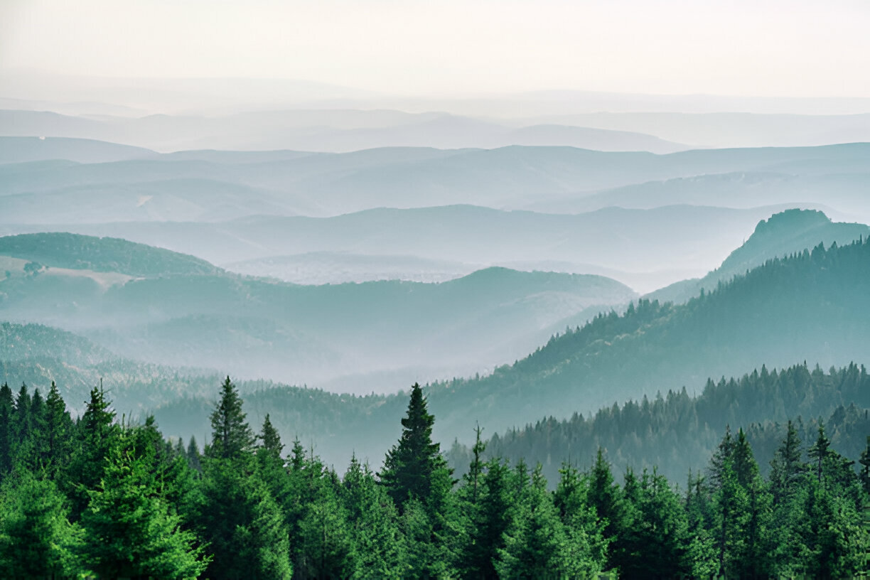
Reforestation Tracking: Sustaining the Green Canopy
Why It Matters
Forests are indispensable carbon sinks and biodiversity reservoirs. They filter air, moderate weather extremes, and sustain countless species. Yet, deforestation—driven by agricultural expansion, urban sprawl, and resource extraction—continues to erode these vital ecosystems. Knowing where, when, and how reforestation efforts succeed or fail is paramount for reversing this trend.
How MEFFEL Helps
MEFFEL’s Reforestation Tracking service combines satellite-based remote sensing with on-the-ground validation to offer precise monitoring of forest restoration projects. We start by using high-resolution imagery to map areas identified for reforestation. These maps help establish baselines—outlining tree density, soil health, and even topographical features that affect growth rates.
Once saplings are planted, our analytics platform tracks vegetative changes in near real-time. By comparing updated satellite data against the baseline, we assess seedling survival rates, canopy cover expansion, and overall forest health. Should any portion of a newly planted forest struggle—due to poor soil conditions, invasive species, or insufficient rainfall—we can flag it for immediate intervention. This level of detail ensures that reforestation initiatives aren’t just well-intentioned but actually flourish over time.
Pollution Detection: Guarding Air, Water, and Soil
Why It Matters
Pollutants in the air, water, or soil have ripple effects that can undermine human health, disrupt ecosystems, and accelerate climate change. Identifying sources of contamination swiftly can prevent minor issues from becoming large-scale crises, all while maintaining public trust in government bodies and private enterprises.
How MEFFEL Helps
Our Pollution Detection service employs a multi-tiered approach. We integrate data from ground-based sensors, satellite imagery, and specialized software to locate sources of pollutants—from illegal dumping sites to industrial emissions. By applying machine learning algorithms to this data, MEFFEL can detect anomalies—such as sudden spikes in nitrogen dioxide in the air or unusual pH levels in a water body.
Following initial detection, we work with local stakeholders to confirm the cause and severity. Remediation strategies may include site cleanups, installation of pollution control equipment, or adjustments in regulatory compliance measures. Because of our real-time monitoring capabilities, you’re informed immediately when pollutant levels breach acceptable thresholds, enabling quick, decisive responses that protect public health and preserve natural habitats.
Biodiversity Mapping: Preserving Life’s Rich Tapestry
Why It Matters
Biodiversity is essential to Earth’s resilience. Each species, from the tiniest microbes to apex predators, has a unique role to play in maintaining balanced ecosystems. When habitats degrade and species disappear, entire ecological networks can collapse. Monitoring biodiversity is therefore critical for evaluating the health of any environment—be it a rainforest, coastal wetland, or urban green space.
How MEFFEL Helps
MEFFEL’s Biodiversity Mapping service harnesses remote sensing technologies, field surveys, and ecological databases to track the distribution of flora and fauna across diverse landscapes. We develop detailed maps pinpointing critical habitats, nesting sites, and migration corridors. This approach isn’t limited to counting species; we delve into population trends, genetic diversity, and interactions between species.
By analyzing these patterns, conservationists and policymakers can make more targeted, impactful interventions—such as designating protected areas, implementing invasive species control, or designing wildlife corridors that reconnect fragmented habitats. Our dynamic mapping system also allows for ongoing updates, making it easier to assess the impact of conservation measures or to modify strategies as new threats or opportunities arise.
Why Choose MEFFEL?
- Integrated Services: Reforestation Tracking, Pollution Detection, and Biodiversity Mapping are powerful solutions on their own. When applied together, they offer a holistic approach to ecosystem management—allowing for coordinated planning, execution, and monitoring of environmental projects.
- Cutting-Edge Technology: We leverage advanced satellite imagery, drone surveys, and sensor networks to gather accurate, up-to-date data. Our analytics platform converts that data into actionable insights, reducing guesswork and enabling timely interventions.
- Scientific Rigor & Expertise: MEFFEL’s team comprises ecologists, data scientists, and field technicians who bring diverse, global expertise. This combination ensures our recommendations align with the latest research and environmental best practices.
- Community & Stakeholder Engagement: Real change happens when communities and policymakers work hand-in-hand. Our processes include transparent reporting, public data dashboards, and workshops to help stakeholders understand findings and invest in long-term solutions.
- Customized Solutions: No two environments are exactly alike. We adapt our services to each location’s unique ecological, cultural, and economic context, ensuring that projects are both meaningful and sustainable.
Building a More Sustainable Tomorrow
From reviving degraded forests to safeguarding natural habitats and cleaning up pollution hotspots, environmental challenges are as varied as they are urgent. At MEFFEL, our ultimate goal is to help you navigate these complexities with confidence, clarity, and impact. By uniting Reforestation Tracking, Pollution Detection, and Biodiversity Mapping under one cohesive strategy, we offer an actionable blueprint for transformative change.
Ready to take the next step toward a healthier planet? Connect with us today to explore how MEFFEL’s integrated approach can bolster your environmental or sustainability initiatives. Together, we can help ensure our natural world remains vibrant and abundant for generations to come.